The leading software for managing urban green infrastructure.

The preferred management SaaS for local authorities and maintenance contractors who need to make better-informed decisions about their green spaces.

Request Demo


The preferred management SaaS for local authorities and maintenance contractors who need to make better-informed decisions about their green spaces.

Request Demo

The most advanced SaaS platform
for urban green management
Streamline your workflow with
Integrated AI

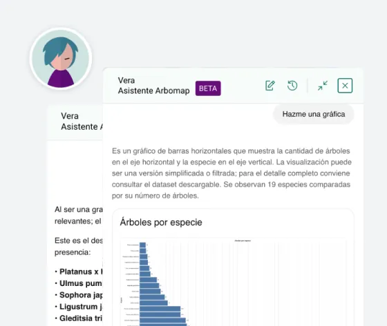
Our Assistant, Vera, will help you extract information using natural language and generate charts for your reports. Our Vera Agent will handle scheduling and distribute tasks among crews.

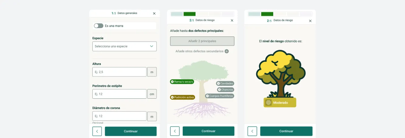
Our Risk AI will assist you in managing tree risk assessments without requiring specialist profiles in-house.

Seamlessly connecting with
your ecosystem

There is no need to change your citizen reporting system, your GIS platform, or your fleet management app. Arbomap integrates smoothly into your existing ecosystem, enriching it with smart green intelligence.

Mobile-First experience,
maximum convenience

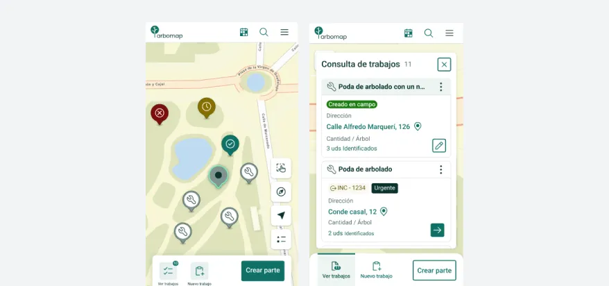
In addition to our fully-featured desktop version, Arbomap includes a dedicated web app designed specifically for mobile devices. This allows you to update your inventory, perform tree and playground risk inspections, and log work orders and incidents directly from the field.

Simplify management — all
your data in one place

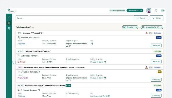
Coordinate maintenance work, manage incidents, view and update your inventory, track tree risk assessments, and extract real-time reports. Everything is consolidated within a single, unified platform. Comprehensive yet effortless.
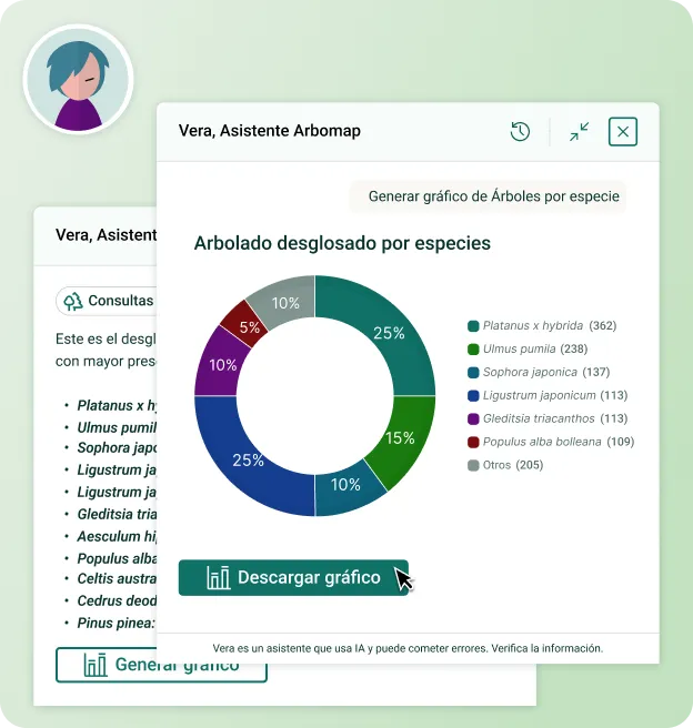
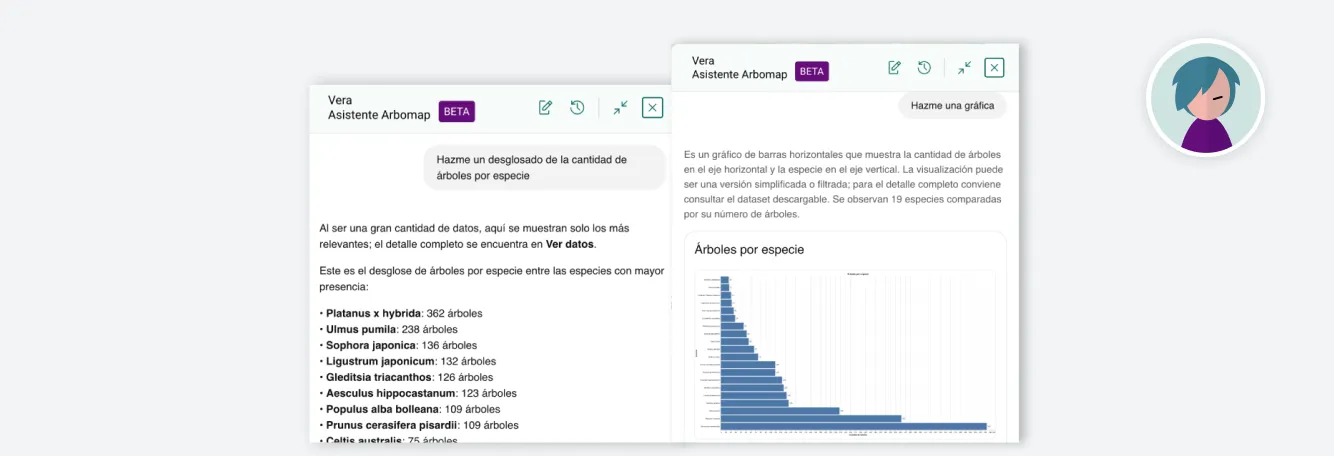
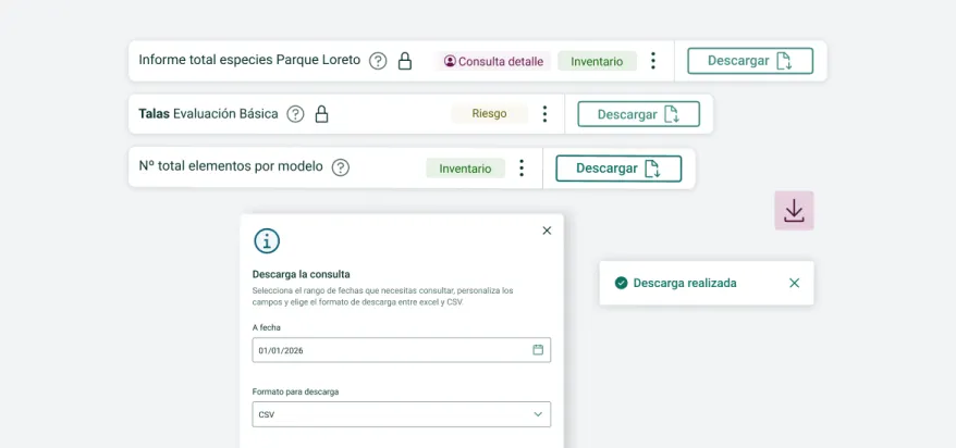
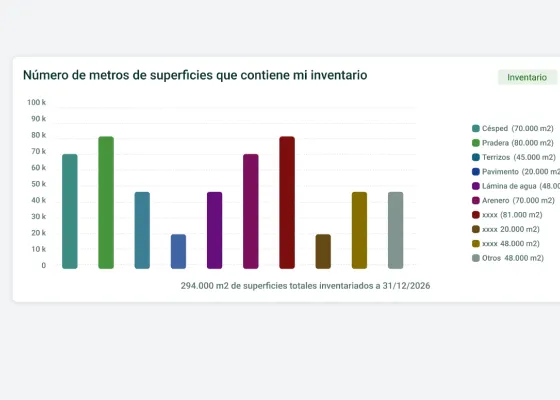
The Vera assistant answers a question in natural language and returns a chart for the report
Streamline your workflow with
Integrated AI

Our Assistant, Vera, will help you extract information using natural language and generate charts for your reports. Our Vera Agent will handle scheduling and distribute tasks among crews.

Our Risk AI will assist you in managing tree risk assessments without requiring specialist profiles in-house.
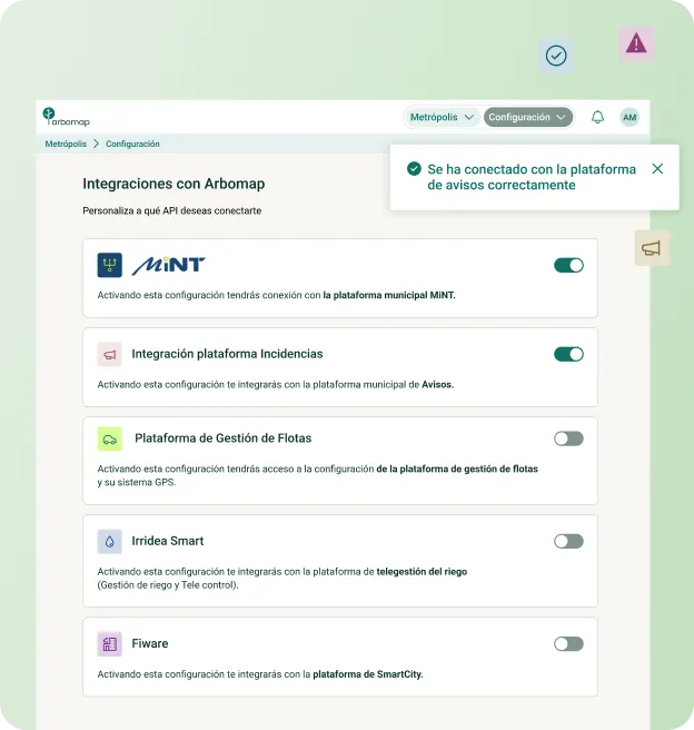
Arbomap connected to other platforms: GIS system, citizen reports and fleet management
Seamlessly connecting with
your ecosystem

There is no need to change your citizen reporting system, your GIS platform, or your fleet management app. Arbomap integrates smoothly into your existing ecosystem, enriching it with smart green intelligence.
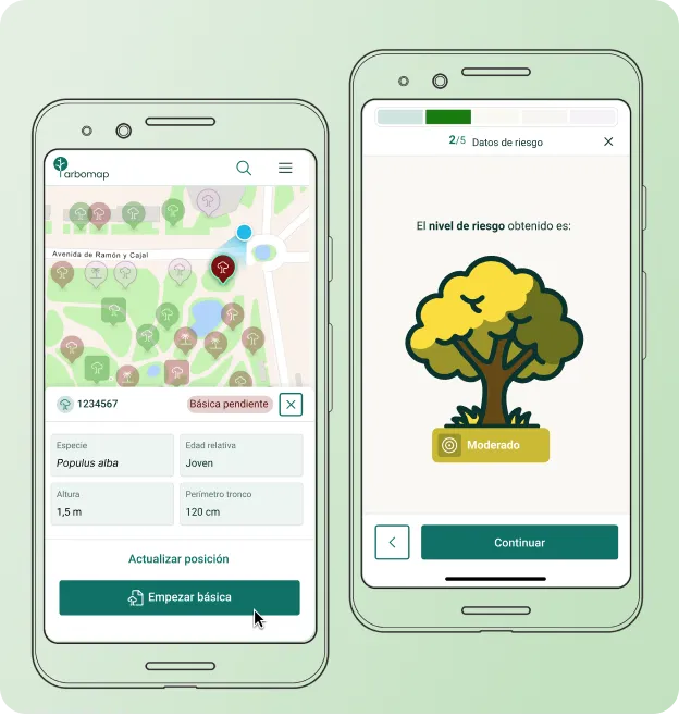
The Arbomap web app on a mobile, with a work report being filled in from the field
Mobile-First experience,
maximum convenience

In addition to our fully-featured desktop version, Arbomap includes a dedicated web app designed specifically for mobile devices. This allows you to update your inventory, perform tree and playground risk inspections, and log work orders and incidents directly from the field.
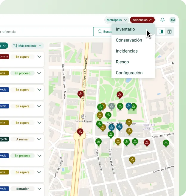
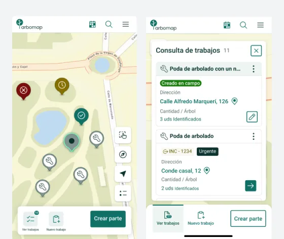
Arbomap screen with the map, the inventory and the outstanding work all in one place
Simplify management — all
your data in one place

Coordinate maintenance work, manage incidents, view and update your inventory, track tree risk assessments, and extract real-time reports. Everything is consolidated within a single, unified platform. Comprehensive yet effortless.

Would you like to see how
Arbomap works?
Arbomap open on a desktop computer and on a mobile at the same time
Modular structure with the most comprehensive
functionality on the market
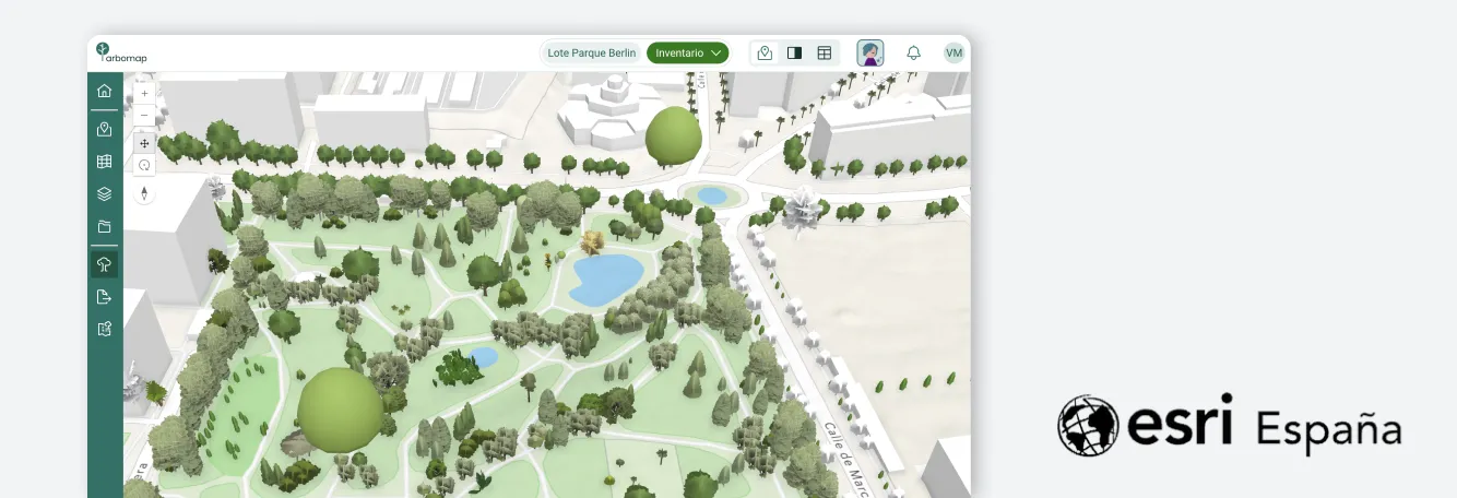
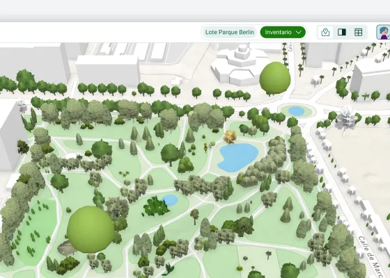
Inventory map with spatial analysis over Esri mapping
GIS with Geospatial Intelligence
Thanks to our partnership with Esri, Arbomap integrates advanced spatial analysis, LiDAR data, cloud services, and geographic intelligence.
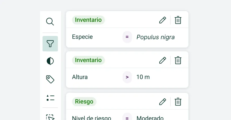
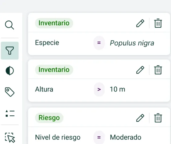
Expression filter builder working on the inventory data
Query Filtering
Build target sets of assets to action with highly precise parameter-based filters.
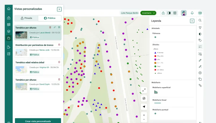
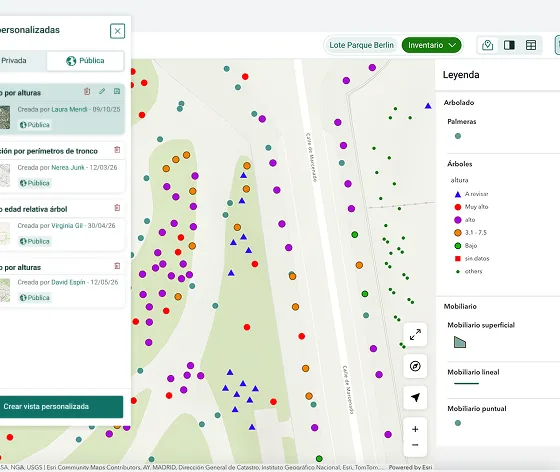
Thematic map with customised symbology and labels
Thematic Maps
Customise your maps to show only the elements you need. Define symbology and labels, and share them easily.
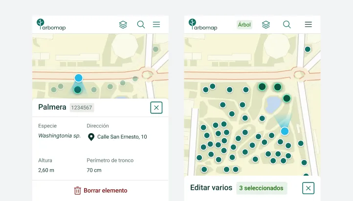
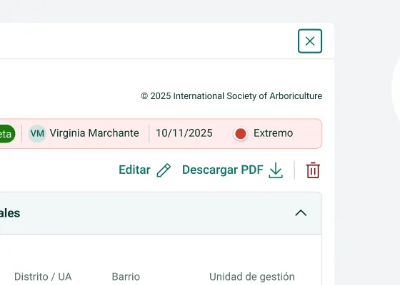
An inventory element record being updated from a mobile
Update Inventory from Mobile
Conveniently update asset data on the go directly from your mobile device.
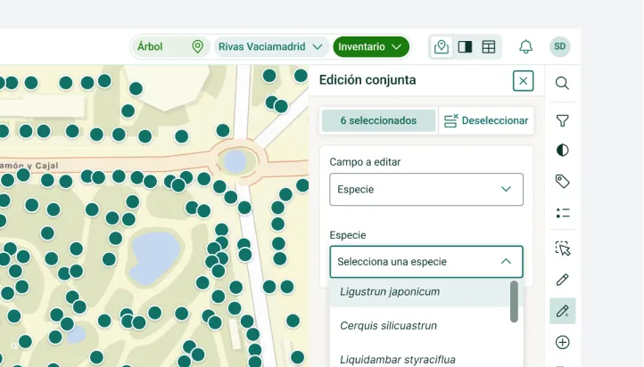
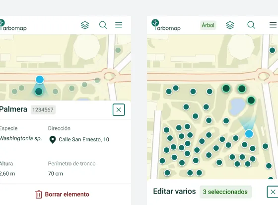
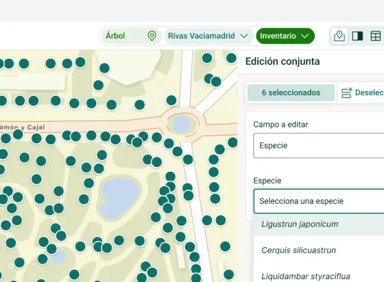
Multiple editing: several elements selected on the map and a shared form
Bulk Editing
Edit attributes for multiple groups of assets simultaneously.
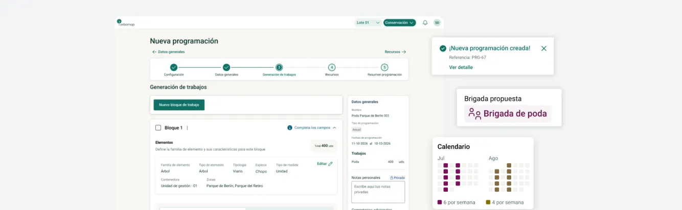
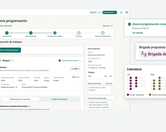
Recurring tasks scheduled with their frequency in the maintenance calendar
Schedule Creation
Translate contract specifications and task schedules directly into the platform. Set up recurring tasks with set frequencies to speed up work order generation once completed.
Crew board in the web app showing the tasks assigned for the day
Crew Board
A mobile web app feature where field crews can view assigned tasks and submit daily work logs at the end of their shift.
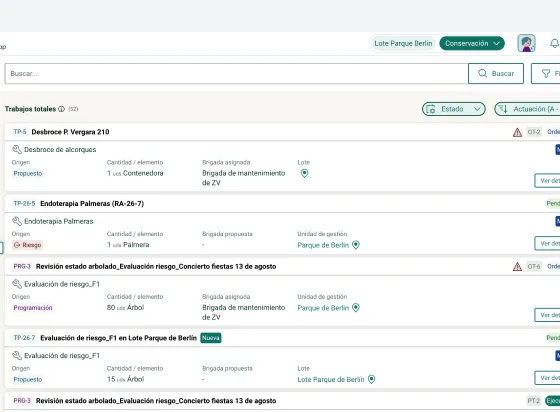
Separate inboxes for proposed works and for work orders
Jobs and Work Orders
Manage proposed jobs and work orders seamlessly, keeping each stage organised in distinct queues.
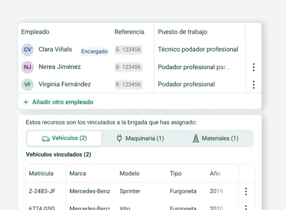
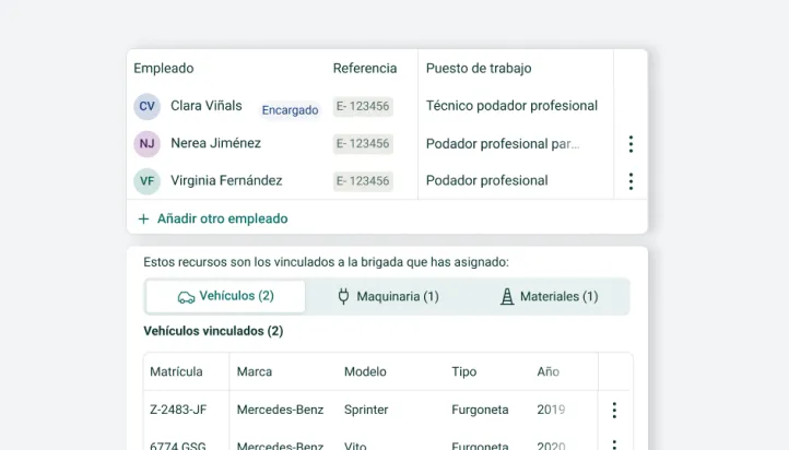
Work report showing the staff absences and the materials used
Human and Material Resources
Log staff absences and materials used directly when submitting a work log.
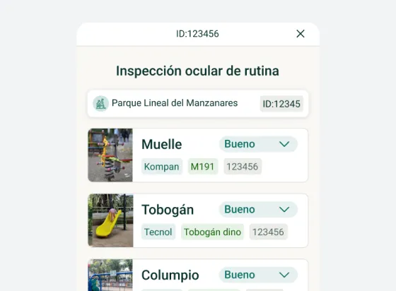
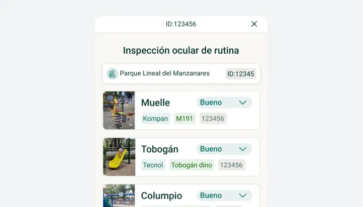
Inspection form for a playground area in the web app
Children's Playgrounds
Schedule visual and functional inspections and fill out compliance forms directly from our web app.
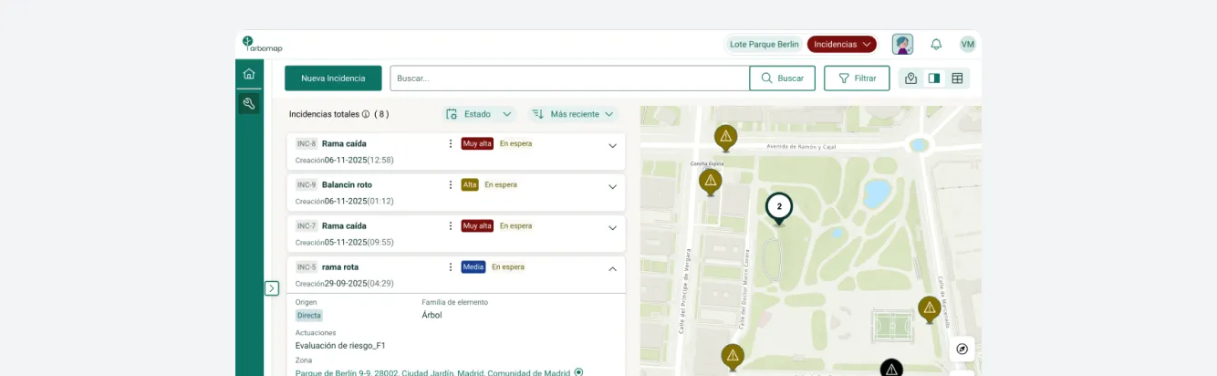
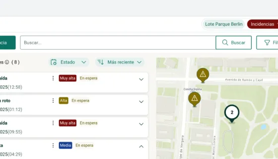
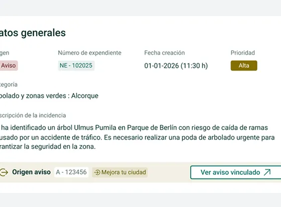
Mixed incident view, with the map and the data table side by side
Issues & Requests Creation and Multiple Views
Create issues directly from the map or via a data form. Customise your interface view to monitor issues and requests using a map view, data table, or a split-screen view.
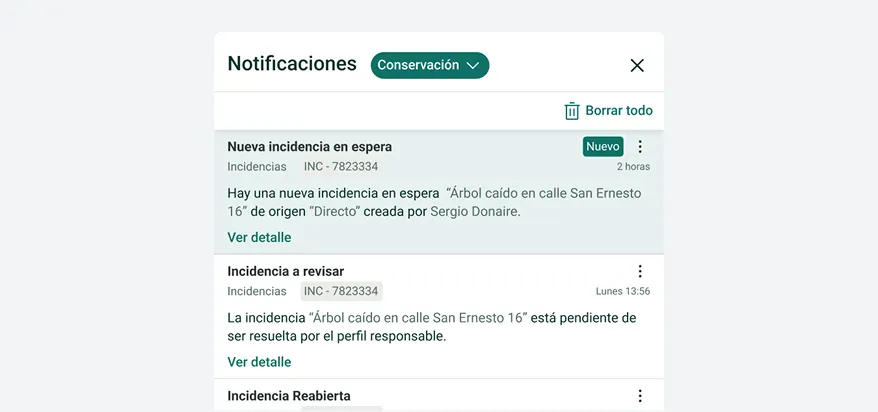
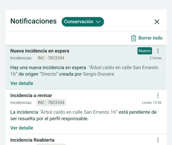
Setting up the notification channels for incidents
Notifications
Customise your notification channels to keep field crews fully informed in real time.
Arbomap connected to an external citizen reporting platform
Integration with External Platforms
Connect with citizen reporting portals to centralise all incoming issues in a single platform.
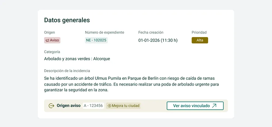
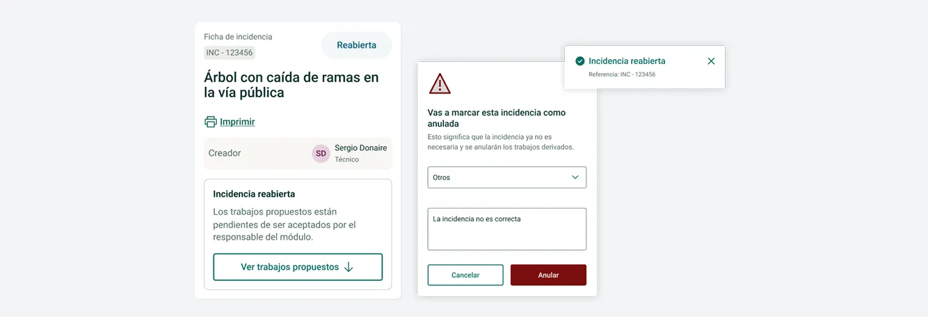
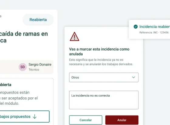
An incident record showing the cancel and reopen actions
Cancel or Reopen Issues
Resolve issues directly from the asset file, cancel them, or reopen them if the work was not completed to standard and requires further action.
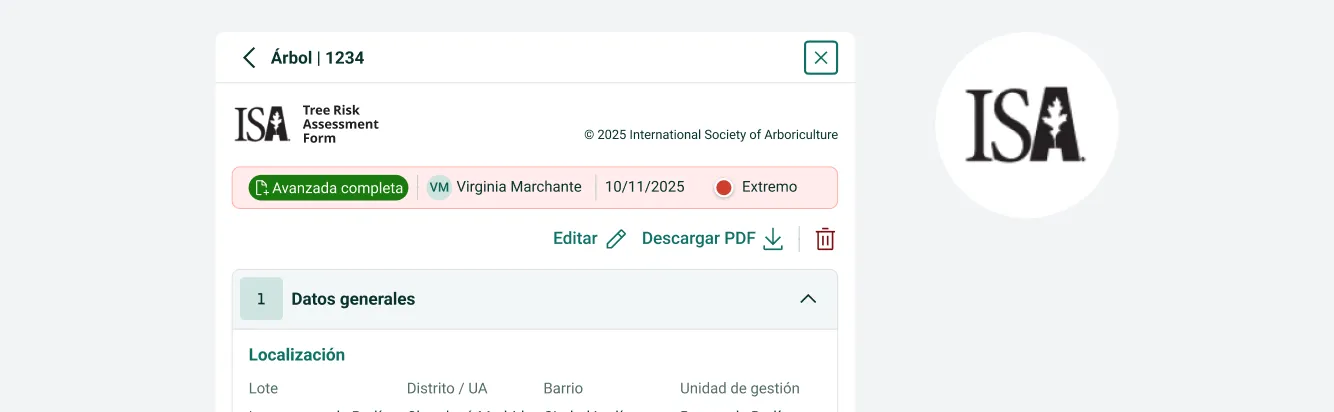
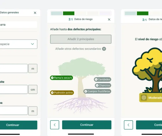
Tree risk assessment form following the ISA TRAQ methodology
ISA TRAQ Methodology
Evaluation forms fully aligned with the ISA TRAQ standard — the most globally recognised methodology in the industry.
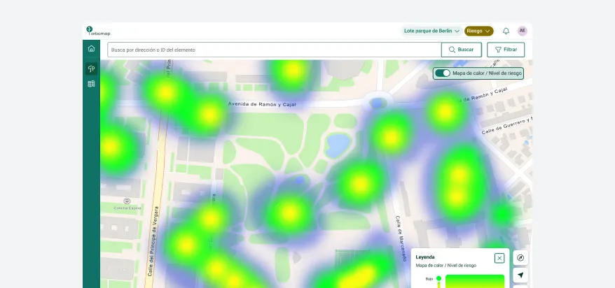
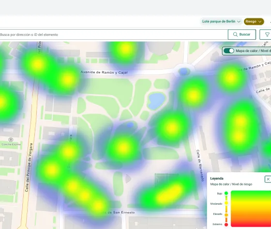
Heat map showing the areas with the highest concentration of tree risk
Risk Level Heat Map
Visualise areas with the highest concentration of risk. Enable the heat map and toggle between inspection status and risk level views.
AI prediction of the risk level, with the re-inspection proposal
Risk Level Predictive AI
Manage risk without relying solely on specialist in-house technical profiles. The AI analyses environmental factors, suggests reinspection intervals, and triggers alerts and safety protocols.
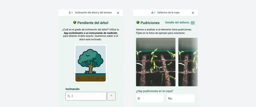
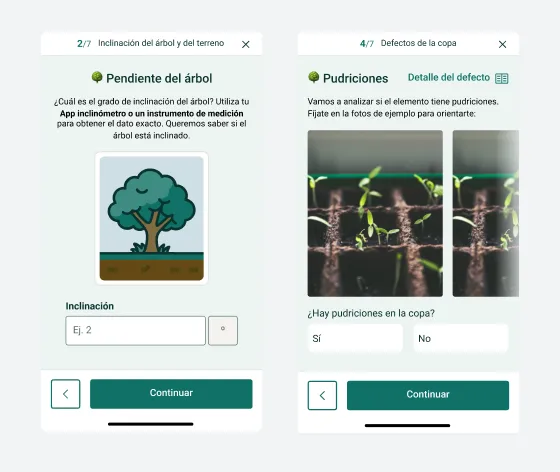
Phased risk assessment form in the mobile web app
Phased Mobile Experience
A step-by-step risk assessment form that allows you to complete evaluations easily and intuitively, focusing on the most relevant data at each stage.
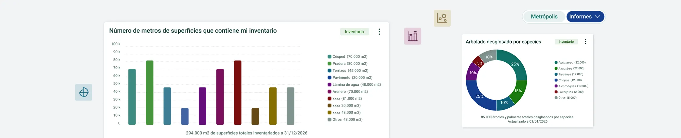
Catalogue of predefined queries and charts by module
Predefined Queries and Charts
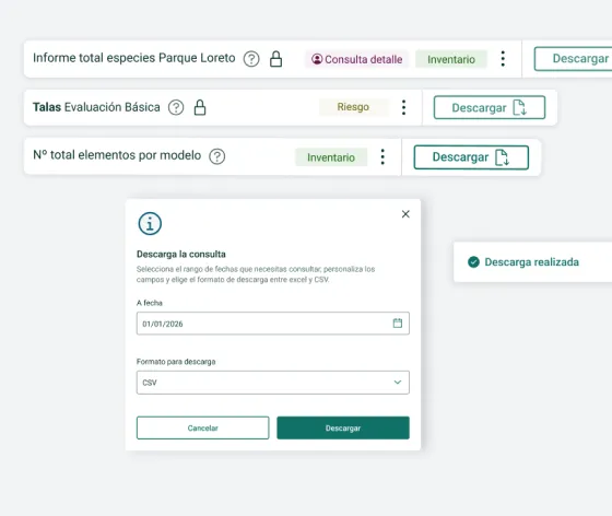
A curated catalogue of standard, recurring queries ready to run. Get the data you need instantly with a single click.
A conversation with Vera, the AI assistant, returning the data that was asked for
Assisted by Vera, Our AI Assistant
Ask Vera what you need to know in plain, natural English — just as you would ask a colleague. She will retrieve the data for you. Intuitive and straightforward.
Custom query prepared by the Arbomap team
Custom Queries
If you require a bespoke query or a highly specific chart, our team will build it for you to access directly in your system.
Modular structure with the most comprehensive
functionality on the market
Inventory map with spatial analysis over Esri mapping
GIS with Geospatial Intelligence
Thanks to our partnership with Esri, Arbomap integrates advanced spatial analysis, LiDAR data, cloud services, and geographic intelligence.
Expression filter builder working on the inventory data
Query Filtering
Build target sets of assets to action with highly precise parameter-based filters.
Thematic map with customised symbology and labels
Thematic Maps
Customise your maps to show only the elements you need. Define symbology and labels, and share them easily.
An inventory element record being updated from a mobile
Update Inventory from Mobile
Conveniently update asset data on the go directly from your mobile device.
Multiple editing: several elements selected on the map and a shared form
Bulk Editing
Edit attributes for multiple groups of assets simultaneously.
Recurring tasks scheduled with their frequency in the maintenance calendar
Schedule Creation
Translate contract specifications and task schedules directly into the platform. Set up recurring tasks with set frequencies to speed up work order generation once completed.
Crew board in the web app showing the tasks assigned for the day
Crew Board
A mobile web app feature where field crews can view assigned tasks and submit daily work logs at the end of their shift.
Separate inboxes for proposed works and for work orders
Jobs and Work Orders
Manage proposed jobs and work orders seamlessly, keeping each stage organised in distinct queues.
Work report showing the staff absences and the materials used
Human and Material Resources
Log staff absences and materials used directly when submitting a work log.
Inspection form for a playground area in the web app
Children's Playgrounds
Schedule visual and functional inspections and fill out compliance forms directly from our web app.
Mixed incident view, with the map and the data table side by side
Issues & Requests Creation and Multiple Views
Create issues directly from the map or via a data form. Customise your interface view to monitor issues and requests using a map view, data table, or a split-screen view.
Setting up the notification channels for incidents
Notifications
Customise your notification channels to keep field crews fully informed in real time.
Arbomap connected to an external citizen reporting platform
Integration with External Platforms
Connect with citizen reporting portals to centralise all incoming issues in a single platform.
An incident record showing the cancel and reopen actions
Cancel or Reopen Issues
Resolve issues directly from the asset file, cancel them, or reopen them if the work was not completed to standard and requires further action.
Tree risk assessment form following the ISA TRAQ methodology
ISA TRAQ Methodology
Evaluation forms fully aligned with the ISA TRAQ standard — the most globally recognised methodology in the industry.
Heat map showing the areas with the highest concentration of tree risk
Risk Level Heat Map
Visualise areas with the highest concentration of risk. Enable the heat map and toggle between inspection status and risk level views.
AI prediction of the risk level, with the re-inspection proposal
Risk Level Predictive AI
Manage risk without relying solely on specialist in-house technical profiles. The AI analyses environmental factors, suggests reinspection intervals, and triggers alerts and safety protocols.
Phased risk assessment form in the mobile web app
Phased Mobile Experience
A step-by-step risk assessment form that allows you to complete evaluations easily and intuitively, focusing on the most relevant data at each stage.
Catalogue of predefined queries and charts by module
Predefined Queries and Charts
A curated catalogue of standard, recurring queries ready to run. Get the data you need instantly with a single click.
A conversation with Vera, the AI assistant, returning the data that was asked for
Assisted by Vera, Our AI Assistant
Ask Vera what you need to know in plain, natural English — just as you would ask a colleague. She will retrieve the data for you. Intuitive and straightforward.
Custom query prepared by the Arbomap team
Custom Queries
If you require a bespoke query or a highly specific chart, our team will build it for you to access directly in your system.
Feature Packages and Pricing
Management SaaS for maintenance companies and public authorities that
need to make better decisions about their green spaces.
Basic
Basic Management
Entry-level plan covering basic inventory, maintenance, and reporting features. Includes mobile web app access for field updates and logging work logs on the go.
  • Inventory + Maintenance + Reports modules
  • Configuration module
  • Web App to update the inventory and create work reports
  • Package for 2 users on desktop and Web App
From €350 / month*
Advanced
Advanced Management
Adds the comprehensive incidents module to the Basic plan, enabling seamless citizen reporting and resolution tracking.
  • Inventory + Maintenance + Reports + Configurator
  • + Incidents module
  • Web App to update the inventory and create work reports
  • Package for 4 users on desktop and Web App
From €650 / month*
Premium
Premium Management
Our complete package. Integrates incident management and specialised tree risk modules with the core platform capabilities.
  • Inventory + Maintenance + Reports + Configurator
  • + Incidents module
  • + Tree Risk module
  • Web App to update the inventory, work reports and risk
  • Package for 6 users on desktop and Web App
From €950 / month*
*Includes: training, support, hosting, and backups across all plans. Expandable with AI features, widgets, custom integrations, and additional users. Implementation fees on request.
Feature Packages and Pricing
Management SaaS for maintenance companies and public authorities that
need to make better decisions about their green spaces.
Basic
Basic Management
From €350 / month*
  • Inventory + Maintenance + Reports
  • Configuration module
  • Web App for inventory and work reports
  • 2 users on desktop and Web App
Advanced
Advanced Management
From €650 / month*
  • Everything in Basic
  • Incidents module
  • 4 users on desktop and Web App
Premium
Premium Management
From €950 / month*
  • Everything in Advanced
  • Tree Risk module
  • 6 users on desktop and Web App
*Includes: training, support, hosting, and backups across all plans. Expandable with AI features, widgets, custom integrations, and additional users. Implementation fees on request.
More Info
Take your green infrastructure
management to the next level
Discover how Arbomap helps cities and organisations plan,
monitor, and protect their urban green spaces.

Request a demo
Speak with our team and discover in just 30 minutes how Arbomap adapts to your organisation's unique needs.
Request a demo
Watch Video
Watch this summary video to explore all the features of our platform and see how it can help you.